 |
| صهاريج المياه بتنيس |
 |
صهاريج المياه بتنيس
|
 |
| صهاريج المياه بتنيس |
 |
| صهاريج المياه بتنيس |
Rapport de M. A. Patricolo sdr les Citernes de Tell Tinnis, dans le Lac Menzaleh.
(Voir les planches I-11I.)
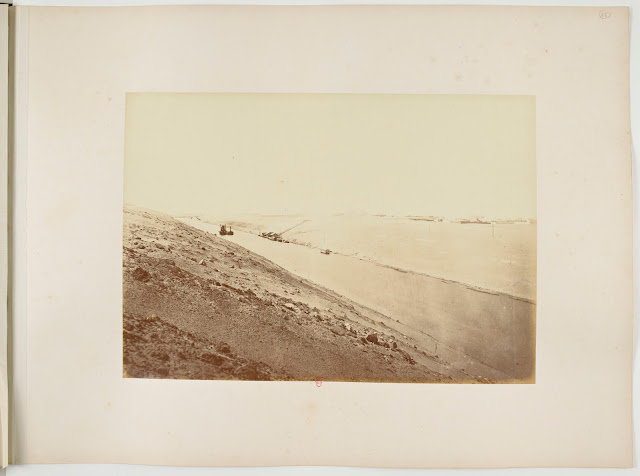
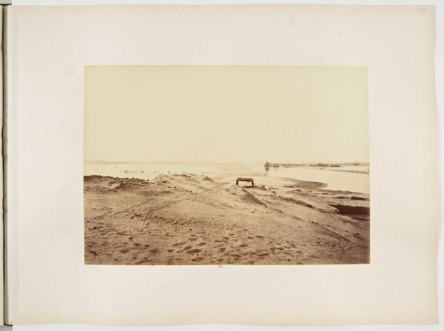
Tell Tinnis est aujourd'hui une très petite langue de terre émergeant du lac Menzaleh, en une série de monticules, sans habitations, sans arbres, sans autre trace de végétation que les mousses et les lichens qui pourrissent dans les marécages de ses abords et quelques touffes éparses de roseaux malin¬ gres et bas.
H suffit cependant de parcourir quelques centaines de mètres de cet îlot, s'allongeant du sud au nord, pour se convaincre que Tinnis fut autrefois un centre habité important. Les monticules ne sont formés que de décombres, où les briques, d'un beau rouge foncé, s'alternent aux débris du mortier caracté¬ ristique des maçonneries arabes de la meilleure époque.
Tout près de son extrémité sud, Tinnis est divisée en deux par un canal qui se dirige aussi du sud au nord et sépare l'ancien centre principal des habitations d'une ruine imposante qui fut une forteresse.
Tinnis est célèbre parses tissus. Ses métiers, que quelques auteurs arabes évaluaient à 5. 000 , étaient, comme l'a démontré M. Schefer sur le témoignage de Yaqout, le monopole des artisans coptes, dont la rare habileté était accom¬ pagnée d'une saleté proverbiale.
— 64 —
M. Ali Bahgat [Manufacture des Étoffes en Egypte au Moyen-Age , communication faite à l'Institut égyptien dans la séance du 6 avril 1903), s'occupa longuement de la notoriété que Tinnis gagna dans cette industrie. Toutefois, il n'est pas sans intérêt de mettre en relief son importance au point de vue de ville arabe.
Nassiri Khosrau, le voyageur qui visita la Perse, l'Arabie, l'Egypte, la Syrie, la Palestine, entre io35 et 10/12, et dont M. Ali bèy emprunte une descrip¬ tion de Tinnis, évalue le nombre de ses habitants à 5o.ooo, et à 10.000 le nombre de ses boutiques. Le traducteur de ce récit, M. Schefer, relève que d'autres auteurs arabes parlent de l'existence à Tinnis de deux grandes et de cent petites mosquées, de soixante-douze églises, de trente-six bains, trente-six pressoirs à huile et cent soixante moulins.
Il y avait de quoi justifier les exploits que les navigateurs corsaires d'occi¬ dent, et surtout de Sicile, accomplirent entre le xe et le xie siècle, dans cette ville, dont l'industrie rapportait au trésor du Sultan mille dinars chaque jour, et où l'on fabriquait des turbans dont la quantité d'or tramé ou appliqué valait à elle seule cinq cents dinars.
Selon Maqrizi , Tinnis était déjà chef-lieu de province sous le Khalife Abbas-side Haroun el-Rachîd, au commencement du ixe siècle. Sa forteresse fut bâtie en 853 (348 de l'Hég.) par Moutouakkil, autre Khalife Abbasside; la ville et la forteresse furent fortement endommagées à la suite des assauts qu'elles eurent à supporter de 1175 à 1 177 ; le pillage et l'incendie obligèrent les habitants à se réfugier à Damiette. Ils y retournèrent, il semble, peu de temps après, parce que le sultan El-Adel, frère de Saleh el-Dyn Youssef ordonnait en 1181 (577 de l'Hég.) la réparation de la forteresse, dépensant près de 3.ooo dinars.
Il est d'autre part fort probable que la ville ne reprit pas son éclat primitif, parce qu'il aurait fallu d'abord tout rebâtir, réinstaller tout, bravant les dan¬ gers de nouvelles incursions, contre lesquelles la forteresse s'était montrée insuffisante.
En 1 192 (588 de l'Hég.) commença la décadence définitive. Le lendemain de la paix que les croisés, conduits par Philippe Auguste et Richard Cœur-de-Lion, avaient dû conclure après la prise de St-Jean-d'Acre , le sultan Sâleh el-Dyn Youssef ordonnait à tous ceux qui ne faisaient pas partie de la garni¬ son de la forteresse de Tinnis, ou qui n'étaient pas valides pour combattre, de quitter la ville et de se retirer à Damiette.
La cinquième croisade, conduite par Jean de Brienne, roi de Jérusalem, et André II, roi de Hongrie (1219-1221), sous prétexte de tenir en respect le Sultan d'Égypte dont la puissance devenait inquiétante, eut pour objectif
— 65 —
principal une tentative de conquête, qui pourtant échoua, à cause des crups du Nil. Les alertes causées par celte tentative déterminèrent en 1226 (6 2 k de THég.) le sultan El-Kâmil à faire démolir tout ce qui restait de la ville, les quelques maisons qui servaient d'asile aux rapatriés et qui n'étant pas affectées à la garnison, auraient pu former, le cas échéant, un abri aux ennemis qui auraient voulu assiéger la forteresse. Maqrizi dit qu'à cette occasion, le Sultan donna en privilège aux habitants émigrés forcément de Tinnis le droit de pourvoir, comme auparavant, au tissage et à la broderie du Tapis Sacré qui tous les ans était envoyé à la Ka'aba.
La forteresse ne fut pas démolie; il semble que la garnison y fut conservée jusqu'à la seconde moitié du xive siècle. Fra Nicolo da Corbizzo, débarquant à Tinnis en i345, dut payer au commandant de la forteresse une taxe pour lui et pour ses compagnons de voyage.
M. Schefer, le traducteur de Nassiri Khosrau, dit que le voyageur Gillebert de Lannoy, en 1�21 , ne trouva de la ville de Tinnis que les ruines, dont il donna une description.
Il est à regretter que celles-ci ne furent exploitées, pendant cinq siècles, que par les pêcheurs du lac en quête de briques. Tout ce que l'ordre du sultan El-Kâmil n'avait pu atteindre, et que peut-être quelques croyances ou superstitions populaires avaient protégé jusqu'à un certain moment (les citernes des anciennes habitations), a été fouillé, ébréché, démoli, même sans avantage pour ceux qui s'y acharnaient.
J'ajoutèrai cependant que, tandis que les ruines de la ville n'offrent aujour¬ d'hui que l'intérêt assez limité de la recherche des différents types de citer¬ nes, les ruines de la forteresse méritent qu'on y tente une étude pour en rele¬ ver, si possible, le plan des anciennes fondations, très probablement enfouies sous le tas de décombres noircis.
Dans la courte excursion, presque exclusivement administrative, que j'ai faite à Tinnis le 3 janvier dernier, le temps restreint ne m'a permis que d'ex¬ plorer et relever quatre citernes, heureusement de types différents.
Elles sont bâties en grosses briques bien cuites, maçonnées avec un mortier de chaux et gros sable, très résistant à l'humidité. A la différence des citernes d'Alexandrie, bâties presque généralement à deux étages, celles-ci le sont à un seul, étant donné le peu d'élévation de leur fond au-dessus des eaux du lac. Des quatre, une seule est couverte d'une voûte à plein cintre; les autres trois ont des voûtes d'arêtes.
Les parois internes sont renforcées par des pilastres formant une légère saillie. Le crépi, épais de deux à cinq centimètres, est composé des mêmes
5 '
matières que le mortier de la maçonnerie, mais il présente la couche exté¬ rieure très finement passée et longuement lissée au fer. Il est fort probable que les ouvriers ont ajouté, dans la composition de cette couche, du lait ou de l'huile, suivant la pratique, du reste commune au moyen âge, pour rendre les surfaces polies et obtenir en même temps une étancheté presque parfaite.
Les coins et les saillies dans les quatre citernes sont en pan coupé : de la sorte, le limon déposé par l'eau introduite ne pouvait pas s'accumuler dans les coins, et le crépi aux arêtes des saillies présentait une plus grande résis¬ tance. Aussi, toutes les parties des citernes échappées à la destruction, pré¬ sentent un état de conservation admirable.
Par rapport aux moyens d'alimentation, on pourrait croire que le plus naturel consistait à déverser l'eau puisée au Nil dans des bassins situés en dehors des maisons, et ensuite, à l'aide de tuyaux en terre cuite, la canali¬ ser jusque dans la citerne qui était probablement placée dans l'enceinte des cours. Dans ma première exploration, j'ai remarqué, en effet, dans un coin de la citerne, l'embouchure d'un de ces tuyaux, dont quelques fragments se trouvent mêlés aux décombres partout ailleurs. Les trois citernes couvertes de voûtes d'arêtes, sont munies d'un orifice en forme d'entonnoir à base carrée, par où on puisait l'eau.
Passant aux détails, en dehors de ceux qui sont consignés dans les dessins de relevé ci-joints, j'ajoute :
I. Première exploration (pl. I)
On pénètre actuellement dans la citerne par une brèche ouverte dans la maçonnerie des voûtes à une de ses extrémi¬ tés. Elle est à moitié remblayée, et elle est divisée en deux travées par des piliers carrés ayant o m. 45 cent, de côté.
La longueur est de 6 m. 3 o cent., sur une largeur de a m. 8o cent, à l'intérieur. A l'extrémité opposée à la brèche d'entrée, la citerne tourne à angle droit, se prolongeant en un couloir couvert de deux croisées de voûtes d'arêtes, aboutissant à un autre couloir semblable, disposé parallèlement à la citerne et mesurant 2 mètres de long sur o m. 75 cent, de largeur.
Le fond de la citerne, découvert près d'un pilier, en face du couloir, permet d'en mesurer la profondeur de 2 m. 5o cent, par rapport à l'intrados des voûtes.
Comme j'ai remarqué plus haut, un tuyau situé dans le coin entre les deux couloirs assurait l'alimentation de la citerne. L'orifice en entonnoir pour la puiser, marqué avec D dans le relevé, est aujourd'hui sommairement bouché avec des moellons à sec et masqué par toute l'épaisseur des décombres.
II. Deuxième exploration (pl. II)
— Celte citerne, dont je n'ai pu relever que les parties à demi remblayées, marquées M, est différente de la première. Elle est double; chacune de ses parties, bâties parallèlement et divisées par un refend de o m. 5o cent, d'épaisseur suivant l'axe principal, était couverte d'une voûte à plein cintre. Les parois, dans le sens de leur longueur, sont renforcées par des pilastres dont les saillies se prolongent recourbées suivant le galbe des voûtes et forment des travées, ayant chacune la largeur d'à peu près un mètre. L'extrémité de chaque travée comporte une petite niche voûtée à plein cintre, encaissée de o m. 12 cent., large o m. 75 cent, et à fond plat. Les deux parties de la citerne avaient, à chacune de leurs extrémités, des niches semblables, ayant pourtant l'intrados plus haut de o m. 3o cent, sur celui des niches d'à côté.
Des dimensions de la citerne dans son ensemble, je n'ai pu mesurer que la largeur, qui est de 5 mètres, y compris l'épaisseur du mur de refend. Par rapport à la longueur, selon l'affirmation du gardien du Service des Antiqui¬ tés qui m'accompagnait, elle serait de 10 mètres et comporterait huit travées, dont les deux accessibles (M du plan), à demi remblayées, conservent leurs voûtes; les trois suivantes (N du plan) ont les voûtes démolies; les trois der¬ nières (O du plan), enfouies sous les décombres, seraient complètes. N'étant pas équipé pour des fouilles, je n'ai pas pu contrôler ce détail, ni vérifier la profondeur de la citerne, qui au dire du gardien précité serait de trois mètres.
Je note en même temps que je n'ai pas pu vérifier si les deux parties commu¬ niquaient entre elles, ni par quels moyens la citerne était alimentée et épuisée.
III. Troisième exploration (pl. III, fig. M)
— La citerne est de très petites dimensions, ne mesurant que 3 m. 5o cent, sur 2 m. i5. Elle est couverte de six croisées de voûtes d'arêtes qui s'appuient aux pilastres du périmètre et à deux piliers à base carrée de 0 m. 22 cent, de côté, bâtis dans l'axe longi¬ tudinal de la citerne.
L'orifice C du plan, qui servait pour puiser l'eau, s'ouvre à trois mètres en contre-bas de la surface de la campagne et permet de pénétrer dans l'inté¬ rieur du réservoir.
Le sol est presque libre de décombres; son niveau moyen se trouve à 1 m. 90 cent. de% l'intrados de la couverture, étant légèrement incliné vers l'angle correspondant sous l'orifice C.
Je n'ai pas trouvé de traces de conduites d'eau; et il faut croire qu'étant donnée la petitesse de la citerne, l'orifice C servait aussi pour le déversement des eaux.
5.
— 68 —
IV. Quatrième exploration (pl. III, fig. N). — Ce dernier type est très res¬ semblant au premier. Le corps principal, couvert de voûtes d'arêtes, mesure k mètres 2 5 cent, sur 3 m. 12 cent.; il est pourvu de piliers centraux et de pilastres de renforcement au périmètre.
Le fond est libre et se trouve à 2 mètres de l'intrados des voûtes. Un petit couloir, long 1 m. 82 cent., en continuation de Tune des extrémités de la citerne et couvert d'une voûte à plein cintre, fait communiquer le corps principal avec une partie carrée de 1 m. 3o cent, sur 1 m. 3o cent., cou¬ verte d'une voûte d'arêtes qui a été enfoncée dans un coin. Cela a causé le glissement de terre et de décombres qui ont presque bouché tant ladite partie carrée que le couloir qui la précède.
La citerne ne finissait pas à cet endroit, mais elle devait continuer paral¬ lèlement au corps principal. Malheureusement je n'ai pas pu fixer cette limite et je n'ai pas trouvé de données suffisantes pour établir les moyens à l'aide desquels on approvisionnait et épuisait la citerne.
Le Caire, le 3o mars 1910.
L'Architecte Inspecteur , A. Pàtricolo.
English Translation using google translate
Report of MA Patricolo sdr the Cisterns of Tell Tinnis, in Lake Menzaleh.
(See plates I-11I.)
Tell Tinnis is today a very small strip of land emerging from Lake Menzaleh, in a series of mounds, without dwellings, without trees, without any other trace of vegetation than the mosses and lichens which rot in the swamps of its surroundings and a few sparse clumps of weedy, low reeds.
It is enough, however, to cover a few hundred meters of this islet, stretching from south to north, to be convinced that Tinnis was once an important inhabited center. The mounds are formed only of rubble, where the bricks, of a beautiful dark red, alternate with the remains of the mortar characteristic of the Arab masonry of the best period.
Close to its southern end, Tinnis is divided in two by a canal which also runs from south to north and separates the old main center of habitation from an imposing ruin which was a fortress.
Tinnis is famous for his fabrics. Its trades, which some Arab authors valued at 5,000, were, as M. Schefer has shown on the testimony of Yaqout, the monopoly of Coptic craftsmen, whose rare skill was accompanied by a proverbial filth.
— 64 —
Mr. Ali Bahgat [Manufacture des Etoffes en Egypte au Moyen-Age, communication made to the Egyptian Institute in the session of April 6, 1903), dealt at length with the notoriety that Tinnis gained in this industry. However, it is not without interest to highlight its importance from the point of view of Arab city.
Nassiri Khosrau, the traveler who visited Persia, Arabia, Egypt, Syria, Palestine, between 1035 and 10/12, and from whom M. Ali bèy borrows a description from Tinnis, estimates the number of his inhabitants at 50,000, and the number of its shops at 10,000. The translator of this account, M. Schefer, notes that other Arab authors speak of the existence in Tinnis of two large and one hundred small mosques, seventy-two churches, thirty-six baths, thirty-six oil and one hundred and sixty mills.
There was enough to justify the exploits that the corsair navigators of the West, and especially of Sicily, accomplished between the tenth and the eleventh century, in this city, whose industry brought to the Sultan's treasury a thousand dinars every day. and where turbans were made, the quantity of woven or applied gold of which alone was worth five hundred dinars.
According to Maqrizi, Tinnis was already the provincial capital under the Abbas-side Caliph Haroun el-Rachîd, at the beginning of the ninth century. Its fortress was built in 853 (348 of the Heg.) by Moutouakkil, another Abbasid Caliph; the city and the fortress were heavily damaged following the assaults they had to withstand from 1175 to 1177; looting and burning forced the inhabitants to take refuge in Damietta. They returned there, it seems, shortly afterwards, because Sultan El-Adel, brother of Saleh el-Dyn Youssef ordered in 1181 (577 of the Heg.) the repair of the fortress, spending nearly 3,000 dinars.
On the other hand, it is highly probable that the city did not regain its original brilliance, because it would have been necessary first to rebuild everything, to reinstall everything, braving the dangers of new incursions, against which the fortress had shown itself insufficient.
In 1192 (588 of the Heg.) the definitive decadence began. The day after the peace that the Crusaders, led by Philippe Auguste and Richard Coeur-de-Lion, had had to conclude after the capture of St-Jean-d'Acre, Sultan Sâleh el-Dyn Youssef ordered all those who did not not part of the garrison of the fortress of Tinnis, or who were not able to fight, to leave the town and retire to Damietta.
The fifth crusade, led by Jean de Brienne, king of Jerusalem, and André II, king of Hungary (1219-1221), under the pretext of keeping in check the Sultan of Egypt, whose power was becoming worrying, had as its objective
— 65 —
principal an attempt of conquest, which however failed, because of the crups of the Nile. The alerts caused by this attempt determined in 1226 (6 2 k of THeg.) the sultan El-Kâmil to demolish all that remained of the city, the few houses which served as asylum for the repatriated and which were not affected to the garrison, could have formed, if necessary, a shelter to the enemies who would have wanted to besiege the fortress. Maqrizi says that on this occasion, the Sultan gave as a privilege to the necessarily emigrated inhabitants of Tinnis the right to provide, as before, with the weaving and embroidery of the Sacred Carpet which every year was sent to the Ka'aba.
The fortress was not demolished; it seems that the garrison was kept there until the second half of the fourteenth century. Fra Nicolo da Corbizzo, landing at Tinnis in i345, had to pay the commander of the fortress a tax for himself and his traveling companions.
Mr. Schefer, the translator of Nassiri Khosrau, says that the traveler Gillebert de Lannoy, in 1 to 21 , found of the city of Tinnis only the ruins, of which he gave a description.
It is to be regretted that these were exploited, for five centuries, only by the fishermen of the lake in search of bricks. Everything that the order of Sultan El-Kâmil had not been able to reach, and that perhaps some beliefs or popular superstitions had protected until a certain moment (the cisterns of the old dwellings), was excavated, chipped, demolished , even without advantage for those who persisted in it.
I will add, however, that while the ruins of the city today only offer the rather limited interest of the search for the different types of cisterns, the ruins of the fortress deserve an attempt. study to identify, if possible, the plan of the old foundations, very probably buried under the pile of blackened rubble.
In the short, almost exclusively administrative excursion that I made to Tinnis on January 3, the limited time only allowed me to explore and survey four cisterns, fortunately of different types.
They are built of large well-fired bricks, masonry with a lime mortar and coarse sand, very resistant to humidity. Unlike the cisterns of Alexandria, which were almost generally two-storeyed, these are only one, given the low elevation of their bottom above the waters of the lake. Of the four, only one is covered with a semicircular vault; the other three have cross vaults.
The internal walls are reinforced by pilasters forming a slight projection. The plaster, two to five centimeters thick, is made of the same
5'
materials than masonry mortar, but it presents the outer layer very finely coated and long smoothed with iron. It is very likely that the workers added, in the composition of this layer, milk or oil, according to the practice, moreover common in the Middle Ages, to make the surfaces polished and at the same time obtain an almost perfect seal. .
The corners and protrusions in the four cisterns are cutaway: in this way, the silt deposited by the introduced water could not accumulate in the corners, and the plaster at the edges of the protrusions presented a greater resistance. . Also, all the parts of the cisterns that escaped destruction are in an admirable state of preservation.
With regard to the means of supply, one might think that the most natural consisted in pouring the water drawn from the Nile into basins located outside the houses, and then, using terracotta pipes, channeling it even in the cistern which was probably placed in the enclosure of the courses. During my first exploration, I noticed, in fact, in a corner of the cistern, the mouth of one of these pipes, some fragments of which are found mixed with the rubble everywhere else. The three cisterns, covered with groin vaults, are equipped with a funnel-shaped orifice with a square base, through which water was drawn.
Passing to the details, apart from those recorded in the attached survey drawings, I add:
I. First exploration (pl. I)
The cistern is now entered through a breach in the masonry of the vaults at one end. It is half backfilled, and it is divided into two bays by square pillars having o m. 45 cents, sideways.
The length is 6m. 3 o cent., for a width of a m. 8o cent, inside. At the end opposite the entrance breach, the cistern turns at a right angle, extending into a corridor covered with two crossings of groined vaults, leading to another similar corridor, arranged parallel to the cistern and measuring 2 meters long on o m. 75 cent, wide.
The bottom of the cistern, discovered near a pillar, opposite the corridor, allows the depth of 2 m to be measured. 5o cent, in relation to the intrados of the vaults.
As I noticed above, a pipe located in the corner between the two corridors ensured the supply of the cistern. The funnel orifice to draw it, marked with D in the statement, is today summarily blocked with dry rubble and hidden by all the thickness of the rubble.
II. Second exploration (pl. II)
— This cistern, of which I have only been able to identify the half-filled parts, marked M, is different from the first. It is dual; each of its parts, built parallel and divided by a wall of o m. 5o cent, thick along the main axis, was covered with a semicircular vault. The walls, in the direction of their length, are reinforced by pilasters whose protrusions extend curved along the curve of the vaults and form spans, each having the width of about one meter. The end of each bay has a small semi-circular vaulted niche, set in o m. 12 cent., wide o m. 75 cent, and flat-bottomed. The two parts of the cistern had, at each of their extremities, similar niches, having nevertheless the higher intrados of o m. 3o cent, on that of the niches next door.
From the dimensions of the cistern as a whole, I could only measure the width, which is 5 meters, including the thickness of the cross wall. In relation to the length, according to the statement of the guardian of the Antiquities Service who accompanied me, it would be 10 meters and would comprise eight bays, of which the two accessible ones (M on the plan), half backfilled, retain their vaults. ; the next three (N of the plan) have the vaults demolished; the last three (O on the plan), buried under the rubble, would be complete. Not being equipped for excavations, I could not check this detail, nor verify the depth of the cistern, which according to the aforementioned guard would be three meters.
I note at the same time that I was unable to verify whether the two parties were communicating with each other, nor by what means the cistern was supplied and exhausted.
III. Third exploration (pl. III, fig. M)
— The cistern is very small, measuring only 3 m. 5o cent, over 2 m. i5. It is covered with six crossings of groined vaults which rest on the pilasters of the perimeter and on two pillars with a square base of 0 m. 22 cents, sideways, built in the longi¬ tudinal axis of the cistern.
Orifice C of the plan, which was used to draw water, opens three meters below the surface of the countryside and allows one to enter the interior of the reservoir.
The ground is almost free of rubble; its average level is 1 m. 90 cent. of% the intrados of the cover, being slightly inclined towards the corresponding angle under the orifice C.
I did not find traces of water pipes; and it must be believed that given the smallness of the cistern, orifice C was also used for the discharge of water.
5.
— 68 —
IV. Fourth exploration (pl. III, fig. N). — This last type is very similar to the first. The main body, covered with groined vaults, measures 25 centimeters by 3 m. 12 cent.; it is provided with central pillars and reinforcement pilasters at the perimeter.
The bottom is free and is 2 meters from the intrados of the vaults. A small corridor, 1 m long. 82 cent., in continuation of one of the extremities of the cistern and covered with a semicircular vault, communicates the main body with a square part of 1 m. 3o cent, over 1 st. 3o cent., covered with a groined vault which has been sunk into one corner. This caused the landslide and rubble that almost blocked both the said square part and the corridor in front of it.
The cistern did not end there, but had to continue parallel to the main body. Unfortunately I could not fix this limit and I did not find sufficient data to establish the means by which the cistern was supplied and exhausted.
Cairo, March 30, 1910.
The Architect Inspector, A. Pàtricolo.
Patricolo Achille, Boinet Albert, Chassinat Emile Gaston, Herz Max. Rapport de M. A. Patricolo sur les citernes de Tell Tinnis, dans le lac Menzaleh. In: Comité de Conservation des Monuments de l'Art Arabe. Fascicule 27, exercice 1910, 1911. pp. 63-68.
DOI : https://doi.org/10.3406/ccmaa.1911.15511


